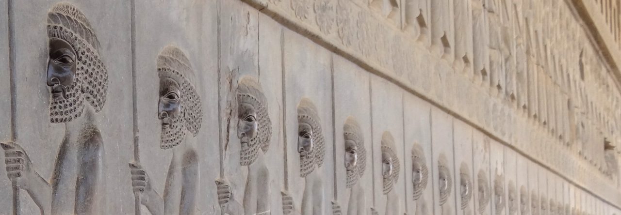
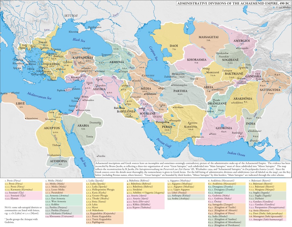
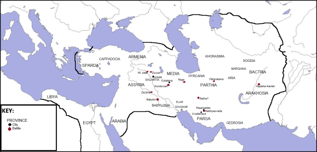
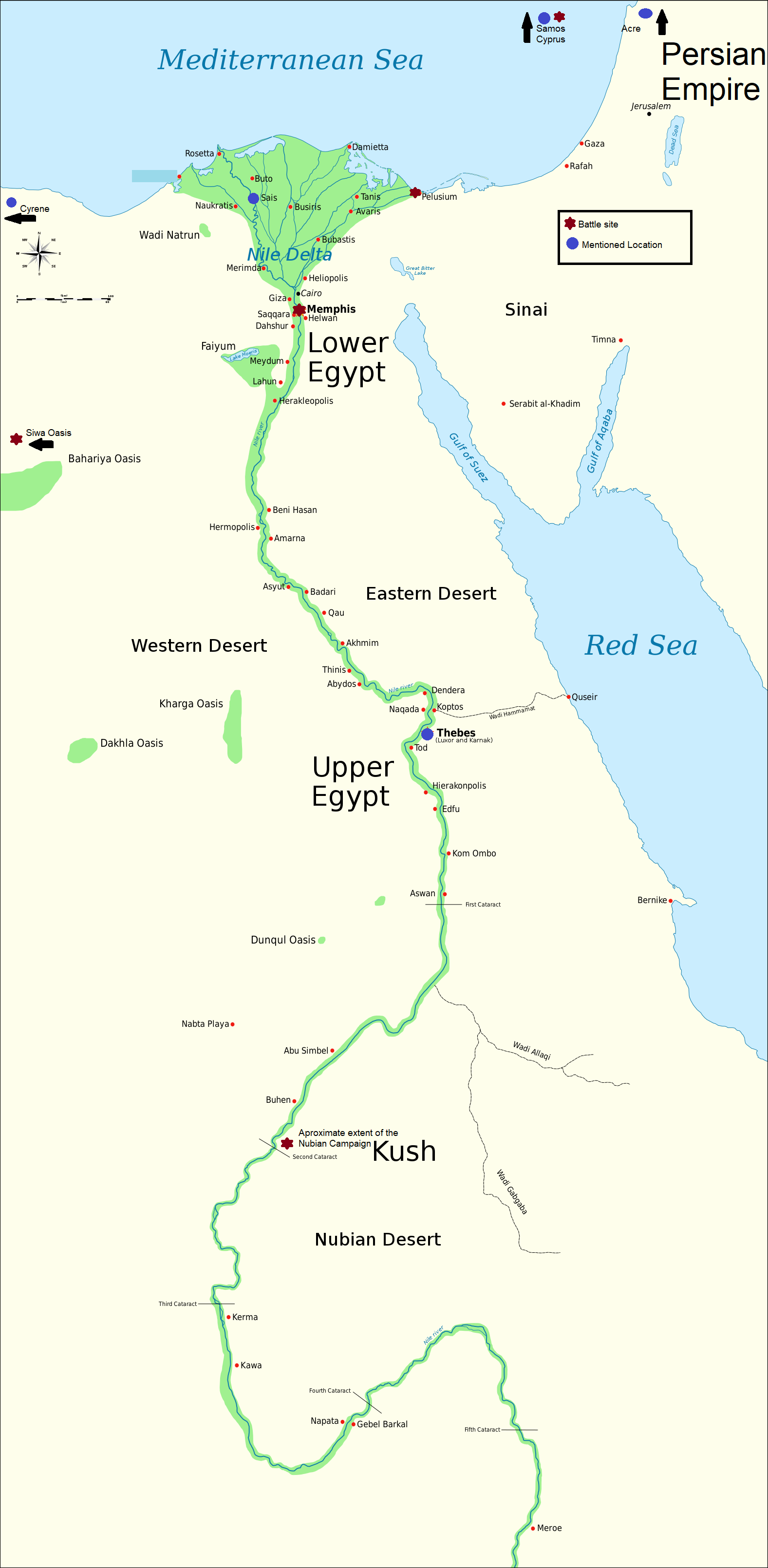
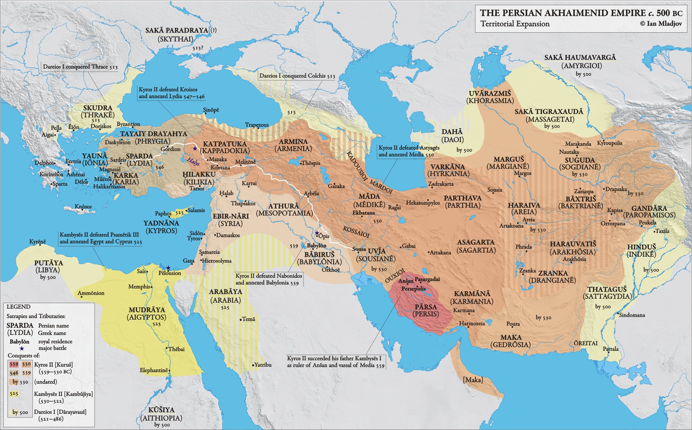
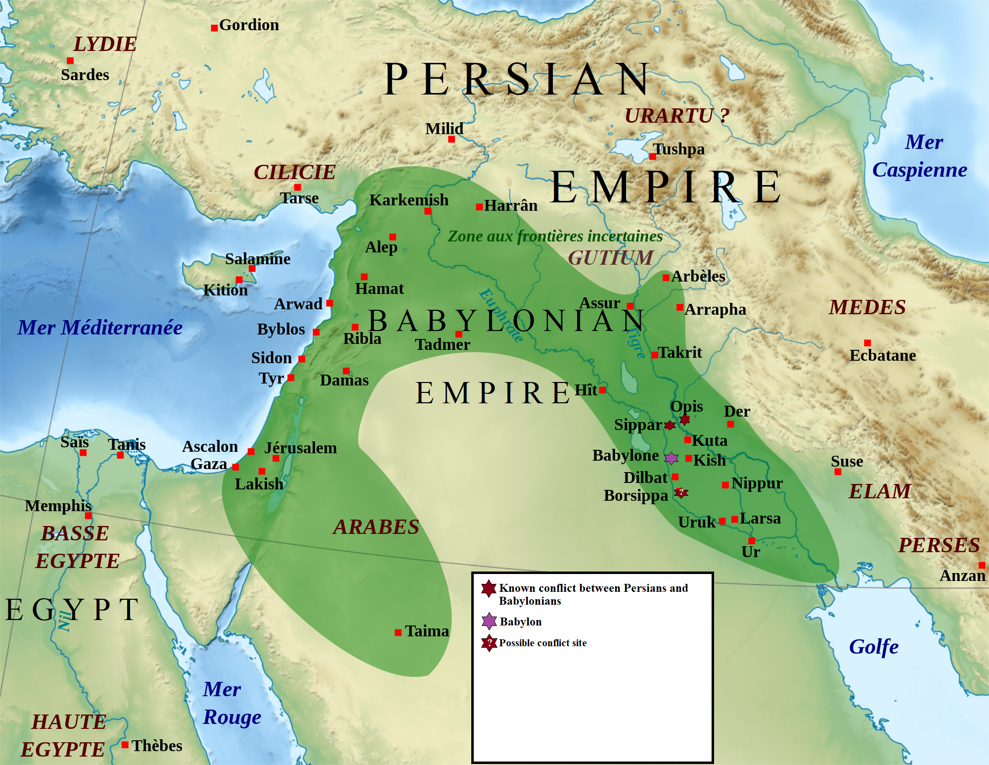
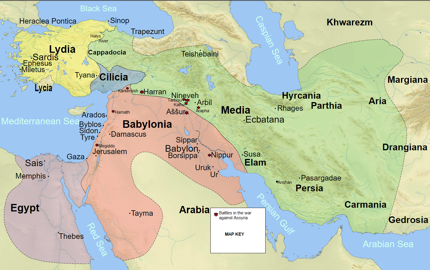
The route taken by Cyrus the Younger and his mercenaries from Sardis to Cunaxa and the return journey Map of Aegean Sea and approximate borders of the various factions during the later Peloponnesian War with some major battles marked via Ian Mladjov’s MapsMap of the approximate boundaries of the Persian Empire and Greek leagues in the Aegean after the Peace of Callias via Ian Mladjov’s Maps.Map of the major battles for the Delian League from 477-459 BCE via WikimediaMap of the Thermopylae Campaign via Wikimedia Episode 49One possible re-creation of the infantry formations at Marathon. via Wikimedia Commons Episode 38A map of all the major Persian offensives against Greeks via Wikimedia Commons. Episode 31-currentThe 10 City-Kingdoms of Achaemenid-era Cyprus, with rough borders via Wikimedia Commons Episode 34The Military Campaigns of the Ionian Revolt via Wikimedia Commons Episode 31-Episode 36Administrative Divisions of the Achaemenid Empire, 490 BC by Ian Mladjov on Ian Mladjov’s Resources. Episode 24-Current A map of Darius’s wars with the Liar Kings with identifiable locations marked. Episode 22 – 23 A map of Ancient Egypt and Kush during Cambyses II’s invasion, with the locations of named locations and battles marked. Image from Jeff Dahl via Wikimedia Commons under GNU Free Documentation License. Episode 16The Eastern Mediterranean Sea at the time of Cambyses II’s invasion of Egypt. Episode 16The Persian Empire up to 500 BCE. Note the key on the bottom left for the different phases of expansion under Cyrus, Cambyses, and Darius. Labels using the Old Persian names with the Greek names in parentheses. By Prof. Ian Mladjov. Episode 8-currentThe Neo-Babylonian Empire at the time of Cyrus’s Conquest with the locations of major battles. The original labels are French, but hopefully similar enough to figure out. Original by Zunkir, Wikimedia Commons via GNU Free Documentation License, Version 1.2. Alterations by Trevor Culley, 2019. Episode 7-8 A map of the Ancient Greek world: the mainland, Peloponnese, Aegean islands, and Ionian coast. Original by MaryroseB54, Wikimedia Commons via Creative Commons Attribution-Share Alike 4.0 International license. Alterations from linked file by Trevor Culley, 2019. Episode 6Map of the Near East under Babylon and Media. Originals by WillemBK and Szajci, via Wikimedia Commons, Creative Commons Attribution-Share Alike 3.0 Unported. Battle sites, Halys River, new cities, and key by Trevor Culley, 2019 Episode 3
Map of Indo-European Migrations. Pink represents the original range. The darker areas represent earlier migrations. The lighter areas represent later migrations. Original image by Joshua Jonathan via Wikimedia Commons, Creative Commons Attribution-Share Alike 3.0 Unported. Text labels by Trevor Culley, 2019. Episode 2
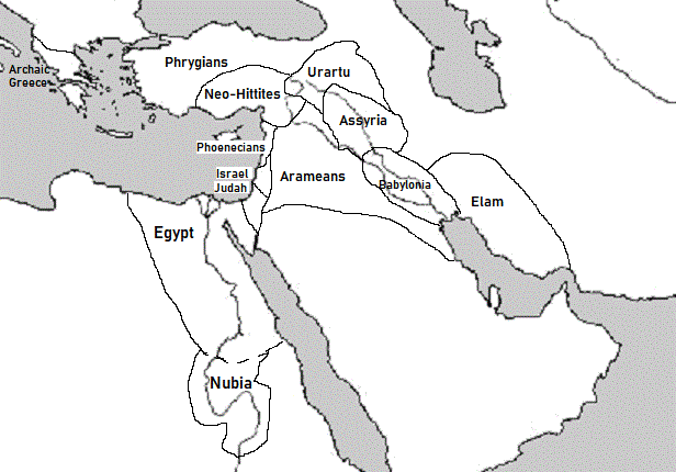
Map of the Neo-Assyrian Empire after its periods of greatest expansion via Wikimedia Commons. Episode 1My homemade map of the Near East between the Bronze Age Collapse and the Neo-Assyrian Empire Episode 1Map of the Near East before the Bronze Age Collapse by Alexikoua via Wikimedia Commons Attribution-Share Alike License Episode 1


